About iGIS
iGIS - The world's first and leading iOS GIS. True GIS functionality is now available on the iPhone! Your iPhone. Your data. Your maps. iGIS represents a new era in mobile GIS solutions by enabling users to load, view, inv
iGIS - The world's first and leading iOS GIS.
True GIS functionality is now available on the iPhone! Your iPhone. Your data. Your maps.
iGIS represents a new era in mobile GIS solutions by enabling users to load, view, investigate, create and export their own data over a background of map service imagery.
Importing data is easy with our unique data import facility using the USB cable or wirelessly on your Mac, PC and Linux. Raster data in many formats (pre-processing required) and ESRI Shapefiles (.shp) are supported at the moment.
Your spatial data is stored on the iPhone, so there’s no need for an Internet connection to see your data – great for field work. We also support over 3000 projections, so no need for re-projection.
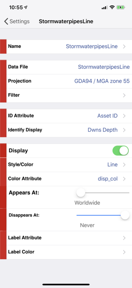
We include support for multiple layers of points, lines, and polygons – all styled as you like. Imagery layers too in V5.
Add comments to your maps - A point layer is added with a name and description field.
Add and edit your own layers, via the map display and customisable data entry forms.
Export your layers to ESRI shapefiles for use back in your enterprise.
Other features include:
- Great speed, using our multi-threaded map renderer.
- Support for large datasets.
- Import and export of ESRI Shapefiles.
- Display current GPS location in your chosen projection ( + compass)
- Zoom to current location
- Zoom to data extent
- Map Pan, zoom in, zoom out
- Changeable drawing styles for a layer: size, color, transparency
- Set the draw order and visibility of map layers
- Set the zoom scale for layers via a simple slider
- Select and interrogate feature attributes via point and click
This application is designed for GIS professionals and an understanding of some basic GIS concepts such as layers, shapefiles, projections etc, would make using iGIS simpler. Please let us know if concepts in iGIS are unclear.
Continued use of GPS running in the background can dramatically decrease battery life.
Feb 22, 2021
Version 8.4.11
Added support for GDA 2020
Previous Versions
Here you can find the changelog of iGIS since it was posted on our website on 2016-09-28 08:14:20.
The latest version is 8.4.11 and it was updated on 2024-04-22 14:41:36. See below the changes in each version.
iGIS version 8.4.11
Updated At: 2021-02-22
Changes: Feb 22, 2021
Version 8.4.11
Added support for GDA 2020
iGIS version 8.2.2
Updated At: 2010-01-05
Disclaimer
Official App Store Link
We do not host iGIS on our servers. We did not scan it for viruses, adware, spyware or other type of malware. This app is hosted by Apple and passed their terms and conditions to be listed there. We recommend caution when installing it.
The App Store link for iGIS is provided to you by apps112.com without any warranties, representations or guarantees of any kind, so access it at your own risk.
If you have questions regarding this particular app contact the publisher directly. For questions about the functionalities of apps112.com contact us.